Wheeling Drainage Ditch Streambank Stabilization Design
Village of Wheeling

OBJECTIVE
Complete the survey, design, permitting, easement acquisition, and construction engineering for approximately 4,350 linear feet of streambank stabilization along Wheeling Drainage Ditch between Northgate Parkway and Dundee Road in the Village of Wheeling. Permitting, easement acquisition, and securing project funding were the critical components of this project.
PROJECT DESCRIPTION
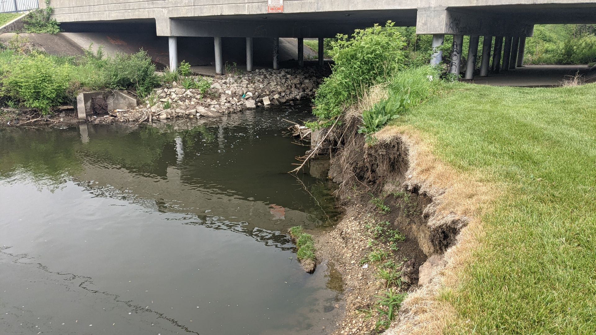
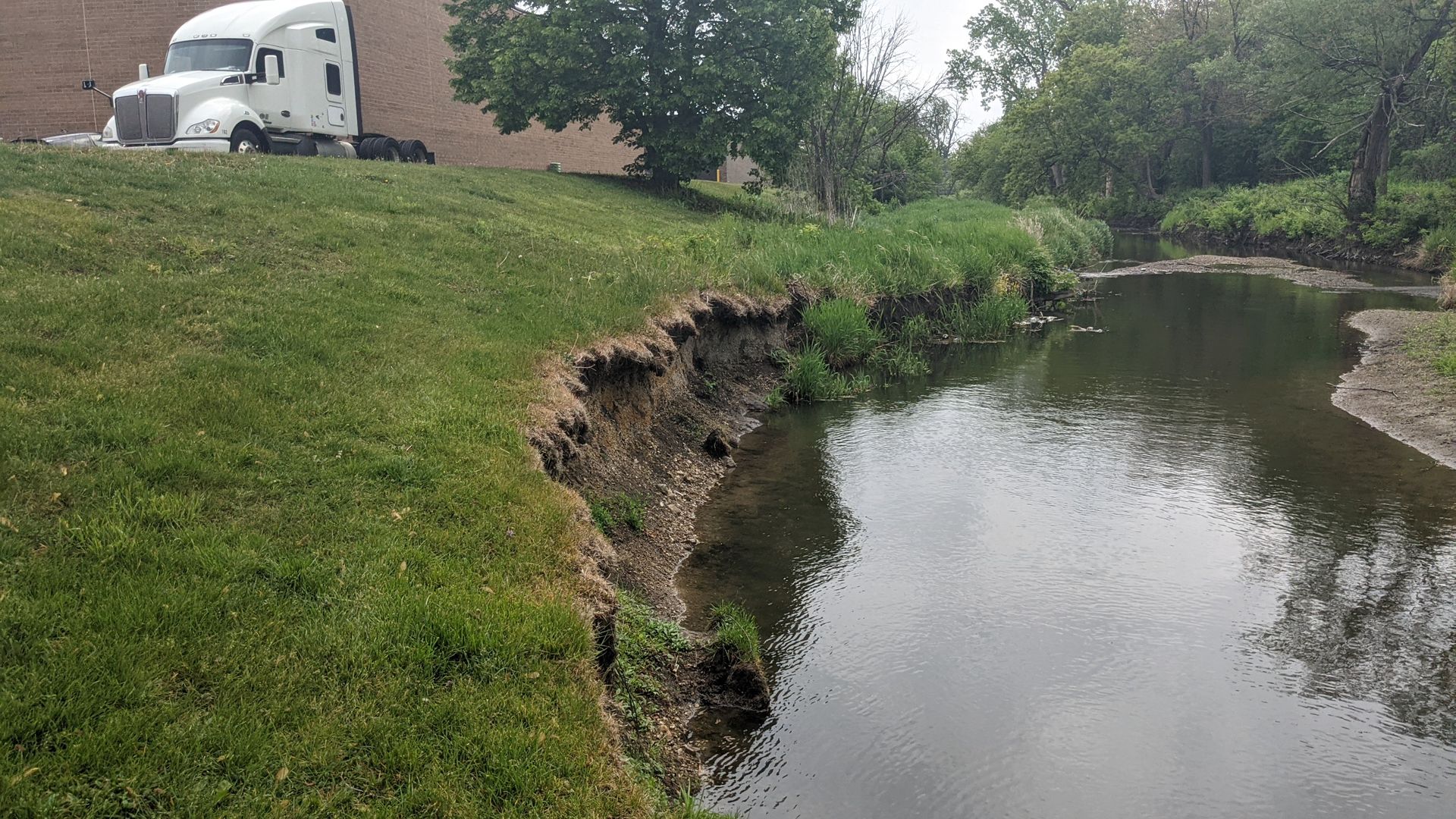
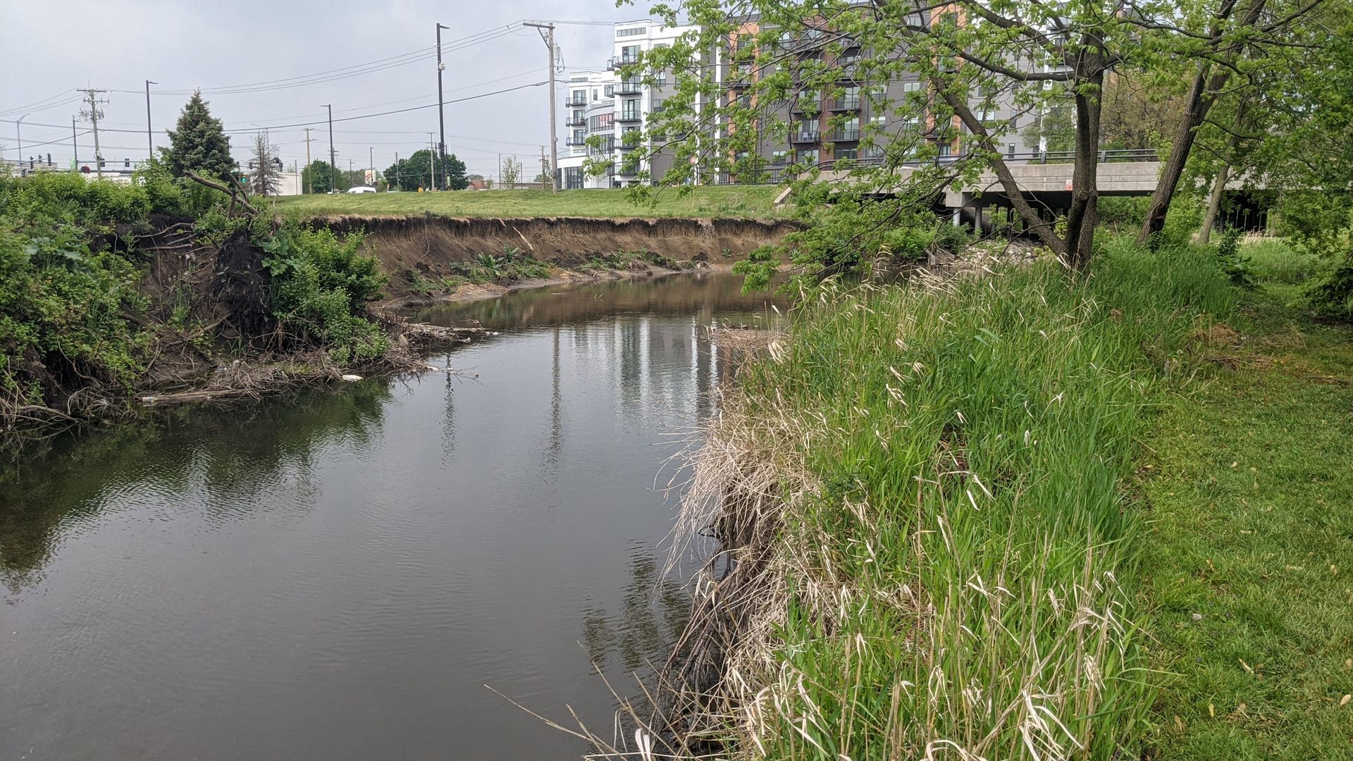
HLR completed topographic survey, stream assessment, design, permitting, and easement acquisition for the Wheeling Drainage Ditch Streambank Stabilization project. Survey efforts in 2022 provided the basis for engineering design and easement plats and legal descriptions. The design incorporates biotechnical stabilization methods—including gabions, floodplain benching, bank regrading, stone toe revetment, and riffles—to improve water quality, protect adjacent structures, enhance drainage, and increase ecological value while minimizing impacts to residents and construction costs.
HLR secured all required permits and agency approvals, including those from the U.S. Army Corps of Engineers, IDNR Office of Water Resources, and the North Cook Soil and Water Conservation District. Hydraulic modeling, including development of a HEC-RAS model, supported IDNR-OWR Part 3708 permitting. Additional environmental services included a tree survey, wetland and WOUS delineation, EcoCAT coordination, debris compliance documentation, and native planting design.
HLR also successfully secured $1,636,860 in IEPA Section 319(h) funding through analysis of watershed impairments and pollutant load reductions. The project will stabilize eroded streambanks, improve water quality, enhance habitat and biodiversity, and improve aesthetics for the surrounding community. HLR prepared bid documents and will provide construction engineering services through 2026.
PROJECT HIGHLIGHTS
- Design of streambank stabilization using gabion baskets, floodplain benching, and green infrastructure
- Coordination with multiple permitting agencies, including IEPA, IDNR, and MWRD
- Topographic and boundary surveys to address right-of-way and easement constraints
- Extensive utility coordination to advance the project to construction
- Awarded an IEPA Section 319(h) grant in late 2024 to support implementation