Land
Surveying
Accurate, responsive surveying services that provide the field data, mapping, and confidence needed to plan, design, acquire, and build successful projects.
overview
Every Successful Project Starts with a Reliable Survey
Engineering, construction, development, and land acquisition projects all depend on accurate base information. Errors, delays, or incomplete data at the survey stage can create costly issues later in design and construction.
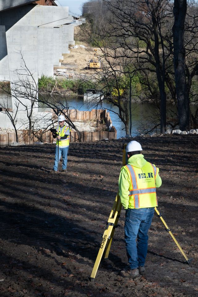
HLR provides professional land surveying services across Illinois and beyond, delivering dependable field data with responsiveness, precision, and clear communication. Our team supports projects of every size with modern technology and decades of experience.
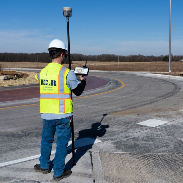
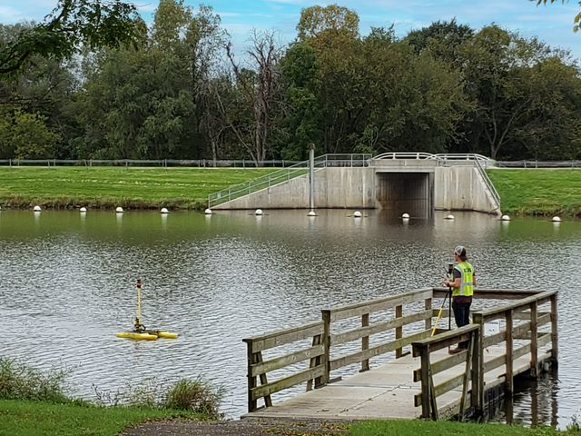
Topographic
Mapping Existing Conditions for Better Design Decisions
Detailed topographic surveys provide the framework engineers and owners need to move projects forward confidently.
- Site topography surveys
- Bathymetric (underwater) surveys for lakes, rivers, and stormwater facilities
- Utility and surface feature mapping
- Countywide and corridor mapping
- CAD / GIS deliverables
- Point cloud and digital terrain data
Boundary
Defining Property Lines With Accuracy and Confidence
Boundary surveys require precision, legal understanding, and deep regional experience.
- Residential and commercial parcels
- Municipal boundaries
- Road right-of-way limits
- Farms and large tracts
- State line and riparian surveys
Route
Supporting Transportation and Utility Corridor Projects
Linear infrastructure projects depend on accurate route surveys that capture real-world conditions over long distances.
- Roadway and highway corridors
- Rail alignments
- Water and sewer routes
- Utility corridor surveys
- Existing condition documentation
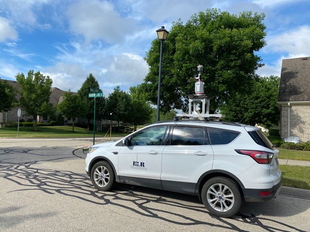
Technology
Advanced Drone and 3D Laser Scanning Solutions
Some projects require faster data collection, enhanced safety, or highly detailed digital models. HLR uses advanced drone platforms, GPS systems, and high-performance LiDAR scanning technology to capture accurate information efficiently.
These tools reduce field risk, improve speed, and deliver powerful data for design, analysis, and documentation.
- Drone aerial mapping
- High-resolution orthophotography
- 3D laser scanning / LiDAR
- As-built documentation
- BIM / Revit / AutoCAD compatibility
- Hazardous or hard-to-access site capture
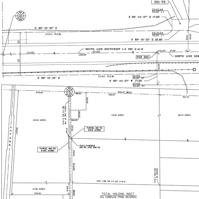
LAND ACQUISITION
Survey Support for Right-of-Way and Property Transactions
Public improvements and development projects often require precise plats, legal descriptions, and title-ready documentation. HLR supports agencies, developers, and property teams with acquisition-focused surveying services.
- Highway plats
- Parcel plats
- Easement exhibits
- Legal descriptions
- Annexation / subdivision plats
- TIF district mapping
RESPONSIVENESS
Technical Precision Backed by Clear Communication
Surveying is more than measurements — it requires coordination, responsiveness, and a clear understanding of project goals. HLR’s surveyors proactively communicate throughout every phase so clients stay informed and projects stay on schedule.
Experience That Supports Projects Across Illinois and Beyond
PROVEN PERFORMANCE
Broad Service Area
Supporting clients across Illinois and neighboring states.
Modern Technology
Drones, GPS, robotic stations, sonar, and LiDAR capabilities.
Diverse Expertise
Public infrastructure, development, boundary, and title survey experience.
Reliable Delivery
Responsive teams committed to accuracy and schedule performance.
get started
Ready to Build Your Project on a Solid Foundation?
Partner with HLR for surveying services that provide the precision, responsiveness, and confidence your project deserves.